Photo Credit: from the collection of Vivian Yess Wadlin
Hidden History at Storm King Mountain
Kris A. Hansen
Along the Hudson River at Cornwall-on-Hudson, nature has been healing the wounds of an embattled past. There is history hidden by the shore, but to discover it necessitates a short journey back to a bygone era. An old, dirt-covered school bus turnaround stands along Bay View Avenue (Route 218) just before the Storm King Highway’s southward ascent up the mountain. The turnaround provides entry onto—not a hiking trail, but the remains of an abandoned public street that once was an extension of Bay View Avenue leading down to the Hudson River’s shore.
This road, long deserted by traffic and neglected of human care, is scarcely accessible except to the adventurous. Shaded by dense tree growth, it descends deep into the woods, following the edge of a drop-off, until the roadbed largely disappears into a dirt path strewn with leaves and pebbly rock. Along this path, unkempt from natural washout, holes, and many fallen trees, a natural wonder- land almost fifty years in the making reveals itself. Autumn is a particularly picturesque time here, as golden leaves float gently down to earth and carpet the landscape with their bronze hue. Deer, wild turkeys, and an occasional coyote make a crackling sound as they scurry across this landscape.
As the steep slope levels off, the path begins to vanish underneath thick overgrowth. The old avenue almost disappears, but through the brush ahead a small, unnamed meadow comes into view. The sudden glare of sunshine stuns the eyes with brightness. The meadow is easily traversed as the terrain becomes flat and clear of rocks. The size of the meadow is apparent; its perimeter is lined with lofty trees probably planted by nature long ago. A wisp of breeze rustles the leaves to create the only audible sounds to be heard in such a beautiful yet isolated place. In the end, nature won, reclaiming for the present a mountainside of untouched beauty.
In 1873, writer-historian Lewis Beach described the beauty of Bay View Avenue:
This is a most beautiful Drive. It appears to the best advantage at sun-set. Commanding a fine view of the water its whole length, it needs the quiet, subdued shadows of evening to bring out the beauties of the scene in their full force… The road is pleasantly winding and unpleasantly short. No one that ever tried it but complained of its limited extent. It leads to the point of Storm-king and is not over a mile in length…1
Today the thick tree growth along old Bay View Avenue obscures clear vistas of the river. However, beyond the meadow and through the trees the first glimpses of it come into view. The now undetectable Briggs Road once intersected with Bay View2; today there is no longer a clear path to finish the trip to the shoreline. The terrain offers space to roam among the tall trees and to explore near the rocks and see the river.
At the Hudson’s shoreline can be found a clue that history dwells here. Hidden across the railroad tracks, imbedded into rock and washed by the river tides, is a metal geodetic marker inscribed “Hubbard 2.” 3 The U.S. Geological Survey’s Earth Science Information Center says it has no information concerning the inscription. However, maps, land records, and census records show that a man named Edward Hubbard lived in this area. The marker may indicate one of the points on his property.
Hubbard was a Hudson River steamboat pilot who moved from Newburgh to settle in Cornwall with his family sometime between 1848 and 1850.4 An ordinary working man, his life was filled with pain and sorrow. He lost his first wife, Sarah, in 1848, most likely in childbirth; his infant daughter died three months later.5 He was destined to lose another wife and several more of his young children during his lifetime.
In 1852, during his residence in Cornwall, Hubbard suffered still more grief. While piloting the new and very popular steamboat Henry Clay downriver on July 28, the craft suddenly burst into flames near Yonkers. Fires raged onboard as more than eighty people perished. Shortly after the disaster, Hubbard and the ship’s other officers were charged with manslaughter.6
The criminal charge hung heavy over Hubbard’s head. If convicted, he faced ten years in prison, leaving his second wife, several children, and many extended family members without his support. As a result of witness testimony at the trial, held in New York City in October 1853, Hubbard was completely exonerated of any wrongdoing. He returned to Cornwall a hero, the result of his life-saving actions at the time of the disaster.7 However, Hubbard did not live the life of a hero. He maintained an unassuming existence, providing for his large family by continuing to pilot Hudson River steamboats.
With the cloud of the trial lifted and a future seemingly more certain, Hubbard and his second wife, Laneretta, purchased ten acres of land at the base of Storm King Mountain.8 The seller was Christopher Miller, a partner of Hubbard’s in a ferry service running between Cornwall and Cold Spring. Their relationship was so solid that Hubbard named one of his sons after Miller.9
Located an easy distance from Cornwall Landing, a frequent steamboat stop, Hubbard’s property was one of several homesteads in the area. For recreation in the mid-nineteenth century, these neighbors watched the never-ending stream of steamboats filled with eager passengers bound for far-off places like New York City or Albany. Nearer to home, a regatta could fill a summer’s day. Local young men from both the Hubbard and Ward families were known to enjoy scull races10 on the river, while their families and friends watched from shore. The elder Hubbard enjoyed a row on the river himself, but at a more leisurely pace. Nathaniel P. Willis, the noted writer who resided in Cornwall (and the man who renamed Butter Hill to the more ominous Storm King), reminisced:
Our boatman was Hubbard, the renowned ferryman between Cornwall and Cold Spring and the indispensable guide to the Highlands and their histories and mysteries…Hubbard telling us something we wanted to know at every dip of his oar… pointed out a fine eagle, swooping around the shoulder of Storm King, as we glided slowly through the water at the monarch’s feet…Hubbard, as you know, has been the pilot on the river through trying scenes…” 11
Those trying scenes had been tempered for the pilot by his family and his home on land bordered by Storm King Mountain on one side and washed by the waters of the Hudson River on the other. Jutting out a bit into the river, the property was known for years as Hubbard’s Point. An old map of Orange County clearly indicates the name “E. Hubbard” at a spot along the Hudson’s Cornwall shore.12
The remains of a stone foundation near the end of old Bay View Avenue may possibly mark the location of Hubbard’s house. Over the years the precise location of his property has been lost; poring through land records proved a formidable task. It must be noted that the method of surveying during that time did not aid in the search. Markers and landmarks were often living pieces of landscape or moveable objects. Such practices were evident in the land records of Hubbard’s purchase, in which cedar trees and piles of rocks were employed as boundary markers:
All that certain lot piece or parcel of land situated in the town of Cornwall county of Orange bounded as follows beginning at a cedar tree on the bank of the Hudson river…running thence up the river as the river runs ten chains to a stone heap near a rock at or by the river thence…to a small cedar marked then south…to a stake + stone heap…” 13
Piles of stones are still clearly visible, but there is no way to confirm with certainty that these mark Hubbard’s land, or if they were actually official markers. However, Hubbard did live on this land and became father to several more children here.
The simple joys in Hubbard’s life turned to grief again in 1860 when he lost his second wife.14 Shortly afterward, Christopher Miller, who held the mortgage on Hubbard’s property, also died. Hubbard was forced to sell his home.15 He purchased a house on Cornwall’s Hudson Street and moved there with his third wife, Sarah Jane.16 By this time, his older children were grown; some had 100 The Hudson River Valley Review married and set off to start their own lives. During the remainder of his life, Hubbard was known simply as “Captain.” When he died in 1893, The New York Times published a simple obituary: “Capt. Edward Hubbard, one of the oldest of Hudson River pilots, died at his home, in Cornwall, Thursday.” 17
The land once known as Hubbard’s Point experienced many changes in later years. It eventually made its way into the hands of a man named Dean; for a time, it became known as Dean’s Point. (Local residents still refer to it as such.) The fact that it was previously known as Hubbard’s Point had been lost to history.
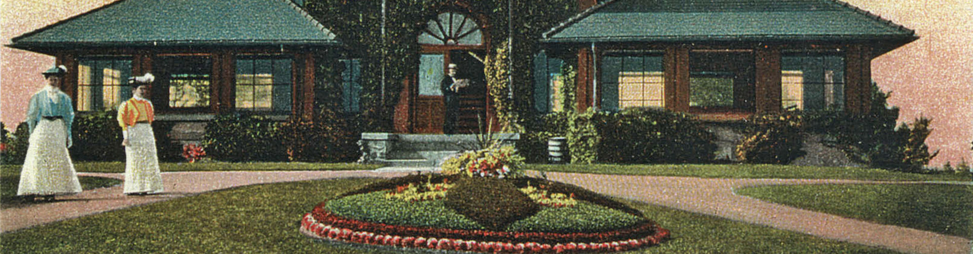
Sometime after the mid-nineteenth century the community at the fringe of Storm King Mountain became home to a vibrant summer-resort industry. Hudson River School paintings and the writings of N.P. Willis enticed vacationers from New York City to flock to Cornwall for a sojourn far from the steaming metropolis. Grand Victorian homes that graced the Hudson River along the length of Bay View Avenue were converted to boarding houses or hotels.18 In time, properties such as Hubbard’s were sold, divided into smaller parcels, and resold several times over.
In the 1880s, the railroad cut around Storm King Mountain along the river’s edge and across the former Hubbard’s Point.19 Miles of track were laid, making it possible for freight trains to make their way through the Hudson Highlands. Chugging engines sliced through the mountain silence, bringing soot and smoke. Opportunities were lost and found. A new boat landing by Hubbard’s Point never came to pass,20 perhaps a sign of times to come. However, a new railroad depot was constructed at Cornwall-on-Hudson (which had separated from Cornwall). It was so popular that it eventually was expanded.21 Soon, Cornwall Landing became a railroad hub for the shipment of Pennsylvania coal.22
In the early twentieth century, the land at the base of Storm King Mountain, especially around Hubbard’s Point, experienced another change. Plans were drawn to bring the New York City Aqueduct through Cornwall by way of Bay View Avenue, passing directly down to the old Hubbard’s Point property and then across the Hudson River by tunnel. Excavation and drilling, shafts and tunnels, and tracks for a narrow-gauge rail line peppered the landscape with the debris of demolition. Curious onlookers came to check on the progress.23
During the 1920s the new Storm King Highway was completed, offering improved transportation in the Hudson Highlands.24 However, this modern venture could not stop what was perhaps inevitable—the area around old Bay View Avenue ultimately fell into ruin. Any remaining homes, vacation hotels, and boarding houses were demolished in what became the final insult to this mountainside community.
In the 1960s, Consolidated Edison planned to install an 800-foot-long powerhouse at Storm King Mountain, with a huge reservoir atop it.25 The company brought in roaring bulldozers whose hungry blades tore into the once pastoral mountainside, altering the landscape forever. Old survey markers were consumed by massive earth-moving machinery as cedar trees fell to the earth and piles of rocks were turned over into the dirt. The sounds of destruction rang through the Highlands as more of Bay View Avenue history was erased.
Following seventeen years of litigation this land was returned to the people. Con Edison was forced to stop its project. Unfortunately, what remained at the base of Storm King was a desecrated and severely altered landscape. Some of this land fell under the stewardship of the Palisades Interstate Park Commission (PIPC)26, which designated it as Storm King State Park. The rest of the land along the old section of Bay View Avenue remained a part of Cornwall-on-Hudson.
During subsequent decades, nature worked to reclaim its place on the mountain. New growth and trees sprung up on the awkward piles of earth that were left to rest where they had been moved by machinery. Animals returned to make their homes or to win back their migration paths. Slowly a living forest emerged.
The meadow that was crossed to arrive at the old Hubbard property is unnamed. However, its location could invoke such a name as “Hubbard’s Point Meadow.” North of this meadow, in plain sight, is a huge rock. Driven into its top is an old iron property stake. At some point, this evidently marked the boundary of one of the land parcels along Bay View Avenue. This rock sits just below another quiet meadow, which could fittingly be called “Bay View Meadow” because of its proximity to old Bay View Avenue.
Between the meadows, there is no easy path to follow, since much of what was easily traversed long ago is now overgrown with brush and trees. A few prickly bushes seem ready to inflict pain upon those who dare to enter; patches of poison ivy in some spots add to a trekker’s challenge. The meadows do not appear to be naturally created but manmade, most likely due to the bulldozing that had been done in the area.
On the north side of “Bay View Meadow” there is an entrance to another abandoned thoroughfare, Shore Road. Through the thick brush, it becomes evident that this road nearly paralleled the railroad tracks. Old stone and brick foundations, a rusted fire hydrant, a fallen telephone pole, and vestiges of what may have been an icehouse sit by the road, serving as reminders that this land once was populated. Beyond the steep ridge along the roadside, sunlight glints off a small pond near the railroad tracks.
For a brief section, Shore Road comes clearly into view, its edges lined with tall shade trees forming a canopy that allows just enough daylight to flicker through to illuminate the way. The gloom makes it easier to envision the time when families like the Hubbards, Wards, and Clarks walked down the road into Cornwall Landing, itself a mere memory.
There is one more meadow to cross, conceivably called “Shore Road Meadow.” Wild grass, some shrubs, and a handful of young cedar trees dot its landscape. Shortly after exiting this meadow to the north, caution must be exercised. Shore Road ends abruptly right at the railroad tracks, where long freight trains often can be seen. A white stone marker next to the tracks reads “N.Y. 52,” indicating that this spot is exactly fifty-two miles north of New York City. Located south of this marker is the tract once known as Hubbard’s Point.
Today, the land at the base of Storm King Mountain holds little resemblance to a time gone by and a life-long past. Although it is impossible to know where the old property lines had been drawn, it is probable that some of Hubbard’s Point and neighboring parcels near the old abandoned Bay View Avenue now sit safely for posterity in the north end of Storm King State Park. Although these lands have been extensively altered by man, history remains there.
To learn about Storm King State Park, visit www.nynjtc.org/index.html or contact the Palisades Interstate Park Commission, Bear Mountain, NY at 845-786-2701.
- Kris A. Hansen is a native of the Hudson Highlands and the author of the book Death Passage on the Hudson: The Wreck of the Henry Clay, (Fleischmanns, N.Y.:Purple Mountain Press, Ltd, 2004).
Endnotes
1. Lewis Beach, “Town of Cornwall: Bay-View Avenue,” in Cornwall (Newburgh: Ruttenbur & Sons Printers, 1873), 98-99. (Courtesy of Janet Dempsey, Cornwall Town Historian)
2. The locations of Bay View Avenue, Shore Road, and Briggs Road are found in land records for the Village of Cornwall-on-Hudson, section 109-1-1, dated 9-11-67.
3. Geodetic marker at Designation: Hubbard 2 Reset, LX 1302, www.ngs.noaa.gov.
4. Federal Census records for 1840 Newburgh, Orange County, New York, and for 1850 Cornwall, Orange County, New York.
5. “Vital Records Taken from the Newburgh Gazette,” Orange County Genealogical Society.
6. Kris A. Hansen, Death Passage on the Hudson: The Wreck of the Henry Clay (Fleischmanns: Purple Mountain Press, Ltd, 2004), 39-40, 112, 167.
7. Ibid., 135-136, 138, 163.
8. Land records for Orange County, New York, Year 1853, Liber 126, p. 29.
9. “Vital Records Taken from the Newburgh Gazette,” Orange County Genealogical Society.
10. Erene Ward Norsen, Ward Brothers: Champion of the World (Vantage, 1958), 17. (Courtesy of
Janet Dempsey, Cornwall Town Historian)
11. Nathaniel P. Willis, “The Convalescent,” in Out-Doors at Idlewild (New York:Charles Scribner, 1855), letter 11 written July 1855 to Morris, printed Home Journal. (Courtesy of Janet Dempsey, Cornwall Town Historian)
12. The name “E. Hubbard” can be found noted on a map presently on display at the Newburgh Free Library Local History Room, Newburgh, NY: Map of Orange County, New York, 1850/1851, from actual surveys by J.C. Sidney C.E. author of Twelve Miles Around New York (Newburgh, NY: Newell S. Brown, Publisher), map submitted 1851, entered according to an Act of Congress in the year 1850/1851 by Robert P. Smith in the clerk’s office in the District Court of the Eastern District of Pennsylvania. Also Hubbard’s Point is mentioned in a news item of the The Cornwall Times, 13 March 1880.
13. Land records, Orange County, New York, Year 1853, Liber 126, p. 29.
14. Old Town Cemetery records, North Section, No. 1, Newburgh, NY.
15. Land records Orange County, New York, Year 1866, Liber 193, p. 470-473.
16. Land records Orange County, New York, Year 1867, Liber 198, p. 368-369 and Federal Census
records for 1870 and 1880 Cornwall, New York.
17. “Obituary Notes,” The New-York Times, 14 January 1893.
18. Janet Dempsey, with Colette C. Fulton and James I. O’Neill, “Bay View Villa,” Cornwall, New York: Images From The Past 1788-1920 (Cornwall: Friends of the Cornwall Library, 1994), 84.
19. Janet Dempsey, with Colette C. Fulton and James I. O’Neill, “West Shore Depot,” Cornwall, New York: Images From The Past 1788-1920 (Cornwall: Friends of the Cornwall Library, 1994), 70.
20. The Cornwall Times, 13 March 1880.
21. Janet Dempsey, with Colette C. Fulton and James I. O’Neill, “West Shore Depot,” Cornwall, New York: Images From The Past 1788-1920 (Cornwall: Friends of the Cornwall Library, 1994), 70.
22. Janet Dempsey, with Colette C. Fulton and James I. O’Neill, “The Coal Docks,” Cornwall, New York: Images From The Past 1788-1920 (Cornwall: Friends of the Cornwall Library, 1994), 71.
23. Janet Dempsey, with Colette C. Fulton and James I. O’Neill, “The New York City Aqueduct,” Cornwall, New York: Images From The Past 1788-1920 (Cornwall: Friends of the Cornwall Library, 1994), 131.
24. Janet Dempsey, with Colette C. Fulton and James I. O’Neill, “The Storm King Highway” Cornwall, New York: Images From The Past 1788-1920 (Cornwall: Friends of the Cornwall Library, 1994), 138-140.
25. “The Scenic Hudson Decision: Timeline,” Marist Environmental History Project http://library.marist.edu/archives/mehp/scenicdecision.html.
26. Land records Orange County New York, Year 1981, Liber 2218, p. 132-137.
The writer extends sincere thanks to:
Janet Dempsey, the Cornwall Town Historian, for providing historical and location information regarding Cornwall, Cornwall-on-Hudson, Hubbard’s Point, Bay View Avenue, and Shore Drive. Tim Sullivan of the Palisades Interstate Park Commission for historical and map information concerning Storm King Mountain, Storm King State Park, Bay View Avenue, and Shore Drive. John Ansley, head of Special Collections and Archives, Marist College, for access to aerial photos regarding the Con Edison Storm King Mountain project. Kim Bloomer of Hudson Highlands Cruises, Inc. for physically locating the “Hubbard 2” geodetic marker using GPS. Rita Forrester of the Newburgh Free Library’s Local History Room for information regarding the 1850/51 Map of Orange County.